iCMTGIS III 1.2.3
Paid Version
Publisher Description


Supports iOS 11.0 and later versions.
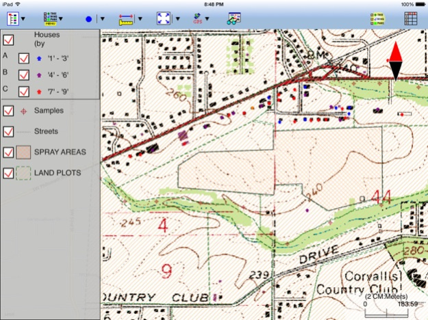
iCMTGIS III is a professional GPS/GIS mapping app that will let you record Points, Lines and Area Features with date/time stamp and pre-defined or manually added descriptions. You could also digitize Features on top of a background map or create points by entering angles and distances. LLA, UTM, State Plane and local coordinate systems supported.You could record your track while performing other tasks using this app. View distances and areas on the spot. Stakeout to points or along a Line or Area Feature. Easily import/export Shapefiles, send/receive files via ftp or email, and store files in the Cloud. Effectively collect data and increase productivity for utilities, natural resources, land management, archeology and other GPS/GIS applications. Please note: Location data depends on the GPS receiver used. Continued use of GPS running in the background can dramatically decrease battery life. iCMTGIS III will let you easily toggle the built-in GPS on or off. This app comes with a built-in help file.
Requires iOS 9 or newer version of iOS.
iCMTGIS III provides the following enhancements over the iCMTGIS II GPS/GIS Data Collection app.
1. Ability to load geo-referenced .tif file as off-line background image for GPS mapping
2.Ability to enter Antenna Height and specify incoming GPS datum for RTK data collection
3. Distance mode for offset GPS data collection
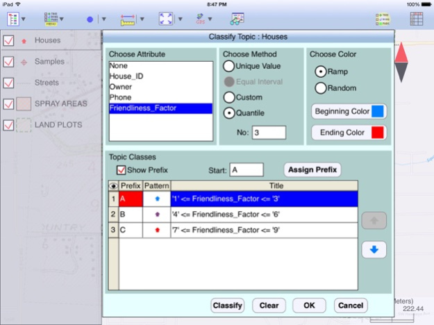
4. Classify Features on a Topic layer
5. Export Shapefiles into a folder; import Shapefiles from a folder
6. Import/Export Feature data in Excel, DXF, KML formats
7. Export Feature data to GPX
8. Import/Export Text Files (with fixed-length field option) for Point Topics
9. Photo support
10. Point Stakeout and Line Stakeout functions.
11. Insert node or Delete node to modify a Line or Area
12. Join or Disconnect Line/Area
13. Nested Point defaults to last used Point Topic.
14. New Feature List format with symbol/pattern support
15. Ability to add built-in Attributes for a Topic
16. Sort/Search/Batch Delete Features and view statistics
17. Create deed plot by entering Deed Calls
18. Export to PDF
Feb 8, 2024
Version 1.2.3
Fixed issues relating to Create Grid and displaying distances on deed plot.
About iCMTGIS III
iCMTGIS III is a paid app for iOS published in the Recreation list of apps, part of Home & Hobby.
The company that develops iCMTGIS III is CORVALLIS MICROTECHNOLOGY, INC.. The latest version released by its developer is 1.2.3. This app was rated by 1 users of our site and has an average rating of 5.0.
To install iCMTGIS III on your iOS device, just click the green Continue To App button above to start the installation process. The app is listed on our website since 2024-02-08 and was downloaded 17 times. We have already checked if the download link is safe, however for your own protection we recommend that you scan the downloaded app with your antivirus. Your antivirus may detect the iCMTGIS III as malware if the download link is broken.
How to install iCMTGIS III on your iOS device:
- Click on the Continue To App button on our website. This will redirect you to the App Store.
- Once the iCMTGIS III is shown in the iTunes listing of your iOS device, you can start its download and installation. Tap on the GET button to the right of the app to start downloading it.
- If you are not logged-in the iOS appstore app, you'll be prompted for your your Apple ID and/or password.
- After iCMTGIS III is downloaded, you'll see an INSTALL button to the right. Tap on it to start the actual installation of the iOS app.
- Once installation is finished you can tap on the OPEN button to start it. Its icon will also be added to your device home screen.
